Rural Tourism
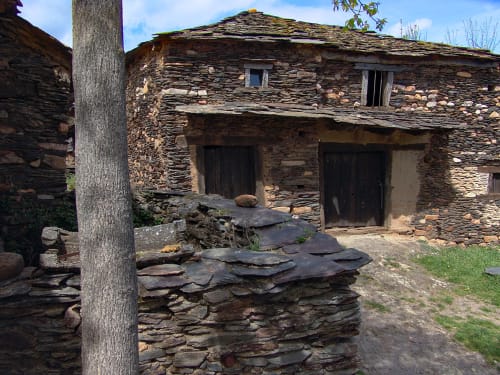
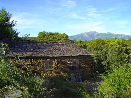
Towns of Black Architecture
The Sierra Norte de Guadalajara
The Sierra Norte de Guadalajara covers an area of 3,340 km2 and includes 85 municipalities where 11,065 inhabitants live. Although it is a large territory, it has a well-defined geographical, social, economic, cultural and historical identity.
A territory that has a large area of protected areas due to the uniqueness and relevance of its ecosystems: Sierra Norte de Guadalajara National Park (Tejera Negra beech forest), Barranco del Río Dulce National Park, La Miñosa Volcanic Hills micro-reserve, Salt River Basin salt marshes micro-reserve, Cueva de los Murciélagos micro-reserve, Canalejas Cave micro-reserve,
Natural Monument of the Sierra Pela and the Somolinos Lagoon and Fluvial Reserve of the Pelagallinas River
Pelagallinas as well as large areas of SCI and SPA protection.
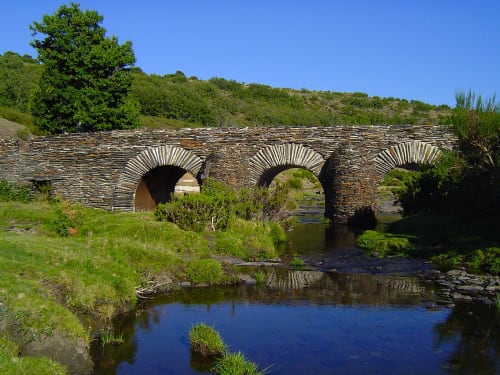
Reservoirs such as Beleña, El Vado, Alcorlo, Pálmaces and Atance constitute a large water reserve where some water leisure activities can be carried out. And in spring it is a great spectacle to visit the "Chorreras de Despeñalagua" in Valverde de los Arroyos.
As for the fauna, the most interesting species due to their scarcity are the otter, the wild cat, the marten, the badger, the polecat, the weasel. Foxes and wolves are beginning to increase their population. In addition to wild boars and roe deer, which are the most abundant.
Regarding small game, partridges, hares, rabbits, turtledoves and various carnivores abound. Among the birds we have the golden eagle, vulture, owl, sparrow hawk, geese, cranes, herons, storks, hoopoes, blackbirds.
More information about the Ruta de los Pueblos Negros, on the website of Adel Sierra Norte: Here
Maps and brochure of the Sierra Norte de Guadalajara in pdf. to plan your stay in time. Download it to your cell phone so you can have it when you need it
A geography marked by its mountain ranges: Sierra Gorda on its border with Madrid, Sierra de Ayllón on its border with Segovia, Sierra de Pela, Altos de Barahona and Sierra Ministra on its border with Soria.
Among its mountains, the highest in the autonomous community of Castilla La Mancha is the Pico del Lobo (2,273m) and the most representative of the province of Guadalajara are the Pico del Ocejón (2,049m) and the Pico del Alto Rey (1,858m).
Discover more:
https://www.turismocastillalamancha.es
https://www.spain.info/es/top/turismo-rural-arquitectura-negra-guadalajara/